Australian Alps Walking Track Crew Guide
What I learned crewing a supported Fastest Known Time on the Australian Alps Walking Track
Recently, I was a part of the crew that helped Bek Stuart set the female supported FKT (Fastest Known Time) on the AAWT (Australian Alps Walking Track). Initially this was a mixed team attempt, but Rex tragically had to withdraw 100 kilometers from the end. This effort was done northbound, from Walhalla to Namadgi Visitor Center.
As this is one of the only supported records on this track (the other being set by Beau Miles) I thought I’d write up some of the lessons we learned so that the next support crew can avoid these mistakes.
Counting the Cost
My first piece of advice: if anyone asks you to crew them for an FKT on the AAWT, just say no. Tell them to do it self-supported and save the both of you some trouble.
But more seriously, this is an intense undertaking. If we consider that the runners will be moving on average 16 hours a day, and you will be helping them after they arrive at camp and before they set off, this means you will be crewing for at least 18 hours a day. If the runners hit a slow patch, they will be in quite late so you will go from less than six hours sleep to less than three hours sleep. There are ways of managing this of course, but crewing this effort was easily the biggest sleep deprivation I have ever experienced.
 |
 |
|---|
Crew members napping during the day after some big nights
Due to limited crew access points, this trail lends itself quite well to the self-supported style. As a crew you will likely only see the runners once during the day and once at night, which isn’t a massive improvement on the 12 drop boxes Tom and Paul placed during their self-supported FKT on the trail.
 Bek being tended to on the last night of the FKT - something the self-supported runners would be missing
Organisation
From crewing multiple events I have learned that crews live and die by their organisation. If there is one truth about elite supported runners, it is that they have very precise preferences, down to the specific flavour of gel, pair of shoes, outfit and particular brand of flavoured milk. Ensuring that you have all this gear in an easy to access spot is no mean feat - especially when you are travelling hundreds of kilometers by car. We kept everything in different bags and boxes sorted by purpose, such as breakfast, snacks, dinner, clothes, tents, and cooking.
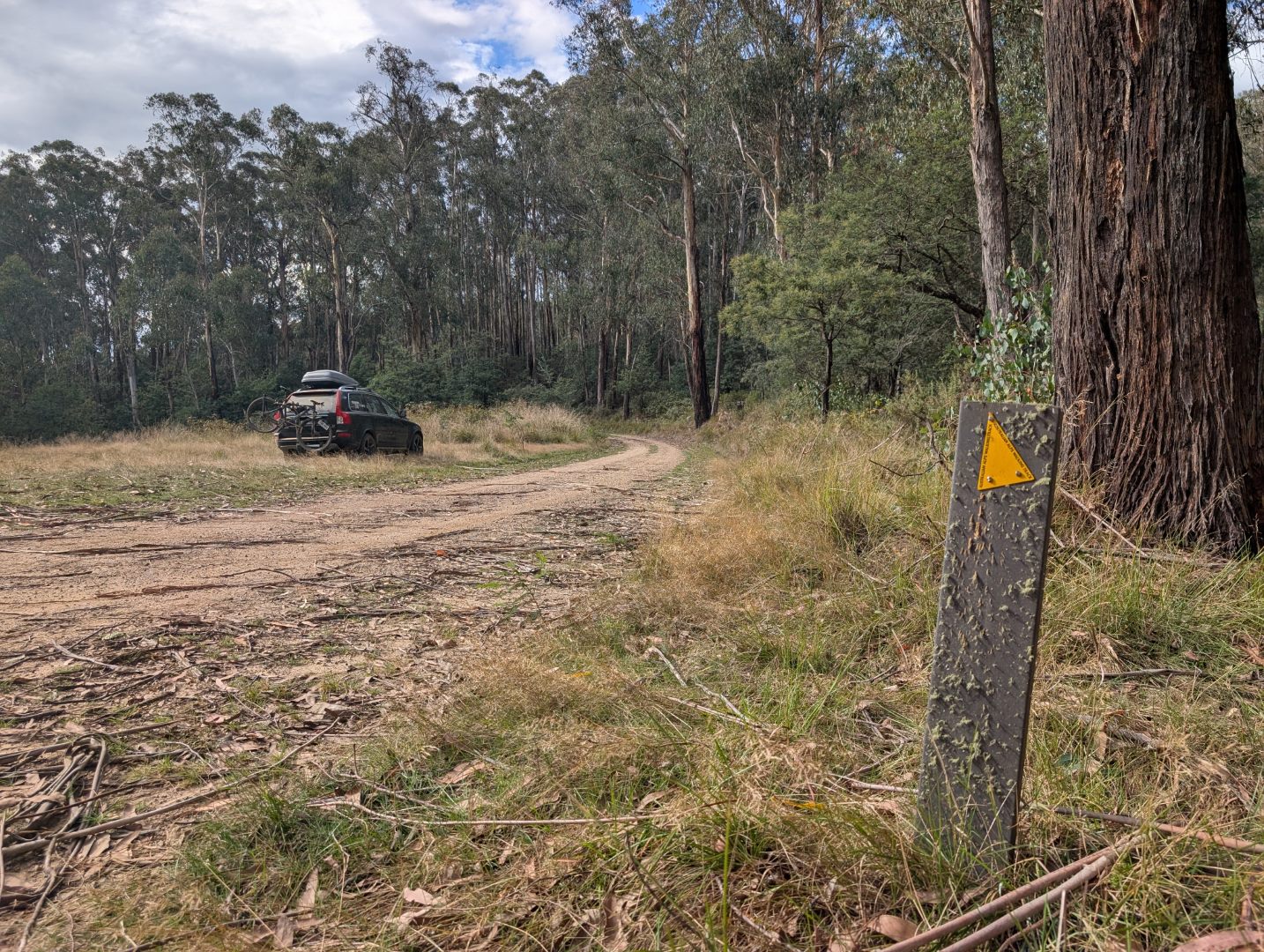
 Car full of gear and ready to drive to the next aid station
However I would suggest organising the supplies so there was one box per day, similar to a self supported set up. This means that you have less to unpack, find, and then repack into the car. Obviously there will be stuff you need every day, but this will cut down the large majority of the items you need to find. If you are crewing in shifts, this also means that each crew only needs to keep the supplies for their days, and can transfer the daily items more easily.
At the end of each crew shift it took multiple hours to transfer the gear from car to car, as there was just so much stuff, and we had so little brain capacity. Crew members would often find themselves just moving bags and boxes around, before stopping and trying to remember what they were doing.
 Gear transfer beginning in Thredbo
Crew structure
Due to the intense loading on the crew, we organised the crew into three teams, who would each provide support for four days at a time. This was a good arrangement, as it’s easy for crews to neglect their own welfare. As part of the second crew team, when we saw the first team in an absolute state four days in, we vowed that we would be more ruthless and look after ourselves. Yet only four days later we were giggling hysterically in the car, realising that we were just as cooked as they were.
As we didn’t have any continuity between teams (aside from ‘The Crew Bible’ which only the first team read) there were a few instances where we repeated mistakes. Having a crew chief stay on for the whole event (like Tara Dower did during her Appalacian Trail FKT) would avoid this - but it’s a big ask.
The first two crew teams were made up of three people in one car, however the third crew team was split into two pairs, with a car each. This was a far superior arrangement. The pairs would leapfrog each other, giving each pair more time to set up and pack down their aid station or camp. It also allowed more options for muling, as the other pair could set up the next aid station while a mule was out on the trail.
One night we had a crew member’s parents join the crew, and they did a great job crewing the crew - reminding everyone to eat and drink. This would be a good role to assign to a member of each crew team to ensure that they are are able to continue crewing well.
Runner-Crew Relationship
Initially we promised the world to the runners, saying that they should make the most of being crewed. However, this is not a track race where you sit in a tent and the runner comes past every 400m. The logistics of the AAWT mean the crew is not an unlimited resource. Instead, the crew is an extremely limited resource.
Before the event, it’s important to discuss the runner-crew relationship. We didn’t talk about these things enough and it led to many suboptimal decisions and unclear situations. You should discuss how much support you will provide, how fussy they can be, how much to push them, who makes decisions (runner vs crew), and safety considerations. Consider every situation of “what could go wrong”, so that when things do go wrong, it doesn’t get awkward. As a crew we had to constantly deal with our runners splitting up which we hadn’t thought about, as everyone assumed that wasn’t even on the table.
It’s also useful to talk about strategy and tactics ahead of time - how many hours do the runners want to walk each day, how much sleep deprivation can they handle, and how much night walking can they tolerate. By the end of the FKT the crew will be making most of the major decisions, so this is something you all want to be on the same page about.
On the seventh night of the FKT the runners set off from the Cowambat Track road access point at 9pm with a mule (me!). It was cold and rainy the whole night. The aim was to make it to Tin Mine Hut, where crew team three had set up camp, riding in from the north side. This goal ended up being unrealistic - Rex made it in around 1am, but Bek was still 12km out at 2.30am. When Bek started suggesting sleeping in the foil blanket on the ground, I knew it was time to let her know I was secretly carrying a tent. Once she was in bed, I proceeded to the hut with Rex’s sleep gear. After making a wrong turn I made it into the hut at 4am. If we had have discussed strategy a bit more, the crew may have felt more comfortable directing the runners to camp a lot earlier - when the pace began to slow down rather than pushing so deep into the night. In the end we ruined a good night of sleep and replaced it with a bad night of walking.
 Crew and runners dry their gear by the fire in Tin Mine Hut
Providing a slightly lower level of support on the smaller things would probably be faster overall. Since the crew have the potential to make catastrophic errors, every bit of energy that they can save for the big decisions is worth it.
One night we had to choose between two campsites: one further along, off track and out of reception and another closer option, that was on the track and in reception. We had considered the two options but due to a miscommunication opted for the campsite further along. Unfortunately the section between these two was very overgrown and full of leeches. As darkness fell and the rain set in the runners were swamped with leeches, drawn to their already torn up legs. Realising that pushing on in these conditions was going to be fruitless, Bek asked for an extraction from the Tallangatta Ski Club. However, due to the slow transmissions from the satellite devices, and the length of the drive, the runners were waiting for quite some time. Fearing that they would succumb to the cold, they knocked on the door of the ski club and were warmly greeted by Peter and Teresa. Despite it being 10:30pm, they helped the runners warm up by the fire and offered tea and hot cross buns. Eventually the crew arrived to collect the runners, although they were hesitant to leave the warm ski club. This shows that choosing the end point is one of the most important decisions the crew make each day.
Muling
Muling can be a great aid for the runners, especially during tricky navigation sections or grim situations (like at night). However, there are many downsides to muling, especially on the AAWT.
As a crew, if you have mules with the runners, this increases your support load dramatically. Now you have more people on the track to look after, and less people in the car to do the looking after. Muling is also incredibly taxing on the crew members, and will drain their energy very quickly. We assumed that since the runners would be pretty knackered after the first few days, muling wouldn’t be too bad. However, the record pace is still a decent chop, and if the mule is carrying supplies for the runner, they will be working hard.
On day three we dropped off two mules near Barry saddle, with the mules hiking back along the track. However, this is possibly the slowest section of the track and it took the mules nine hours to meet the runners, by which time the sun was already setting. There was a large section of track where every tree had been blown over and the trail was indistinct. This section also includes The Viking which involves some serious scrambling. Thankfully, together the runners and mules made it back to the access point in only another seven hours, finishing the day after 1am. This was a far longer day than any of us had anticipated - as a result everyone was short on food and water. Instead of having two hungry and dehydrated runners, we had four to look after.
 Bek ascending some ropes near The Viking
We also did some bike muling on the sections that allowed it. Bike muling has a few trade offs. You can carry slightly more load on the bike, it is lower impact and can potentially be twice as fast as hiking. However, it does open up the risk of mechanicals and crashes, and since bikepacking bags are a massive faff, you will probably have a giant pack on anyway. Even on wide open firetrail, the hills will slow down the bikes dramatically. Similar to the mules on foot, the bike mules will be working very hard.
 Bike muling Bek out of Tin Mine Hut
I think muling can still be a useful tool, but it is another aspect of crewing where we underestimated the energy cost. How much muling to do is a judgement call based on the number of crew and their fitness levels, and the purpose of muling that section. Strong reasons to use a mule include morale, safety, navigation, and lack of car access. With that in mind, I think the following sections are particularly worth muling:
- Cowombat Track to Dead Horse Gap. This is a 55km section with no car access, so the only way to provide support is by muling. These are fire roads which are manageable on a bike, however bikes are only permitted on the NSW side.
- The Rolling Ground. This is an off track section, and with tired runners, it is useful to have someone navigating.
- After Ghost Gully. The trail is a bit indistinct here, so it can help to have someone doing the trail finding for tired runners.
Communication
We used two way satellite devices for communication between the runners and the various crew teams. We had both Zoleos and Garmin InReaches. The Zoleo had a few strengths, including:
- easy transfer of device between people
- tracking points can be sent to another Zoleo device, which is handy when both the runners and the crew are out of reception
- the device itself is not too expensive.
However there were also a few gotchas with our approach:
- Once a Zoleo device is handed off, you cannot use the app any more and have to continue your conversations over text - which is annoying if you haven’t already saved all the relevant phone numbers as contacts. You also now have changed phone numbers, which is annoying because…
- InReach devices must text a number first before they can receive from that number. You will probably only figure this out once the owner is out of contact.
- Once the runners are sufficiently tired, they are not going to be able to message and run anyway.
- Zoleo devices by default check for messages every 24 minutes or so, which means if you are trying to have a conversation you might be waiting close to an hour before the other device reads your message and sends a response.
- Zoleo devices can only send tracking points to up to 5 contacts, and the share map feature didn’t work for us. This can be overcome by setting up tracking on a MAProgress page, so that anyone with reception can see where the runners are.
- Our runners were sharing one Zoleo - however when they split up, we had no way of knowing where the other runner was. A spare tracker would have been useful in this case.
Overall the track has more reception than you’d think, and the runners will often move in and out of pockets of reception, which is way better for communication than satellite devices. In order to make the most of this, it makes a huge difference if the crew setup camp in a spot with reception - it’s much easier for the runners to quickly call than to type out a list of wants and needs. The runners found that SMS and WhatsApp performed best in the patchy reception, and Facebook Messenger was not very reliable.
I don’t have many concrete suggestions on how to improve from our setup, but this is definitely an area where gains can be made by some investigation into alternatives and substantial prior testing.
Track Access
We had a mix of 2WD and AWD vehicles, with no 4WDs or 4WD experience, so to increase the access to the track we decided to hike or bike in. These hikes in were often much harder than expected - there’s a reason it isn’t drivable.
 |
 |
|---|
Transporting the gear required on foot or by bike is hard work
For instance, on the third night, the runners stayed at Peak 1162 near Barry Saddle with two crew members. There was a 5km hike with 700m of vert into the track. Since there was no water at the top, we also had to take in about 17L of water (for the dehydrated runners/mules, cooking, bird baths for the runners, to resupply the runner’s packs, and some water for the crew). It took three crew members two hours to hike the gear and water up to the top. Then, once the runners arrived at 1am with the two mules, myself and the mules had to make the hike back down, as we were not able to carry enough sleep equipment or food up to the track. As a result, the crew and mules all got to bed around 4am.
 We were glad to have the car and tarp (although would have preferred an awning!) at Johnnies Top, where the conditions were cold, wet and extremely windy.
I’ve included a list of access points and a map at the end as an appendix.

Camaraderie
Bek and Rex selected quite a diverse set of people to be members of the crew, from loud and proud “inside people” to pure suffer enthusiasts, from weekend warriors to dirt bags. In the lead up they organised a series of crew nights where we would hang out and “plan” the crewing. While not much planning got done in these sessions, we built social connections and became invested in the project.
These bonds between the crew were only strengthened by the experience of crewing, and as a result there weren’t any issues between crew members. Two of the highlights of the crewing experience were the crew changeover points in Hotham and Thredbo, where the old and new crew teams shared a meal together with the runners. At those meals it was clear that Bek and Rex had put together a truly special crew.
 Crew team one and two eating dinner with Bek and Rex in Hotham
When I first joined the crew, Bek told me she wanted to do the FKT supported in order to bring people along for the adventure. My cynical side thought this was a little idealistic, but as soon as the hike was underway it was clear that the teamwork and shared experience was the defining feature of the adventure.
Personal lessons
As with all great adventures, I also learned a few things about myself on this trip:
- I was able to dig a lot deeper and push a lot harder than I expected, because helping your friends is a great motivator.
- Despite them not being great tactical decisions, the “must make” situations we found ourselves in were also great motivators and unlocked an extra gear. Before setting off for Tin Mine Hut, I was cooked and ready to go home. But during the cold and wet night, knowing that I had gear that was needed in the hut and I no longer had a safe sleep setup for myself (having given the tent to Bek) ensured that I did not feel any pain. I just had to get the job done.
- I tolerated a lot more sleep deprivation than normal. I did not manage it well and made a lot of mistakes, but I was mentally ready for that and didn’t beat myself up about it. The next progression will be managing the energy well, so I can turn on and off when required.
Conclusion
Overall, crewing was an incredibly intense experience, similar to a bikepacking trip or an adventure race. Because of this, we all got to experience feelings that you don’t often feel, form many strong memories and friendships, and find out what we were capable of. While I’m not in any rush to do more FKT crewing, it wasn’t deep type two fun - it was only one or two days later that we were all looking back fondly on our time as crew.
 Bek is met at the finish line by Rex and by overall record holder Paul Cuthbert
Appendix: List of potential access points
For each of the locations I will describe it’s distance along the trail (from Walhalla), the access, and any other comments we have. For the accesses we didn’t use, we will have a bit less to go off. This maps information is also viewable in Caltopo. This map is based off The Adventure Gene Ultimate Track Guide’s GPX file, and formed the basis for the map I created.
Some apps that helped us research:
- NewTracs is a community 4wd app. We found there was a bit of variance, there were blue (moderate) trails we could drive and green (easy) trails we couldn’t.
- WikiCamps is good for listing the amenities and reception available at campsites
- Maps.me was good for offline directions between locations.
Mt Erica Car Park
- Distance along trail: 21km
- Access: decent road, a little bit 4WDy, doable in 2WD.
Stonarchs Camp Site
- Distance along trail: 48km
- Access: Good road access.
- Notes: Nice wide open space, beautiful Eucalyptus trees.
Thomson Jordan Divide Road
- Distance along trail: ~56km
- Access: 2wd gravel access
- Note: we did not test this access, although from google maps it looks ok, and Thomson river looks bridged.
Mount Victor
- Distance along trail: 79km
- Access: on road car access
- Note: we camped here, roads and access were good.
Matlock Walhalla Road
- Distance along trail: 82km
- Access: appears to be road access
- Note: we did not use this, as it is accessed from the South East side and we stayed on the North West side of the track.
Mt Skene
- Distance along trail: 113km
- Access: Drive in via Jamieson. Good gravel road, popular among 4WDs, and it is a long drive in
Nobbs Track Helipad
- Distance along trail: 145km
- Access: 2WD access - good roads in, but then a 2.5k hike into the track with 500m of vertical on a very dusty track. No water at top. There is 4WD access from both sides, though it’s unclear which side is easier or if it is worthwhile.
- Notes: we camped here. Taking gear for three crew and two runners up the hill took two hours. We also left some critical items behind, resulting in a largely unloaded second round trip.
Brocks Road
- Distance along trail: 161km
- Access: Similar access to Nobbs Track (only a short drive between the two).
- Note: we did not test this.
Vallejo Gantner Hut
- Distance along trail: 171km
- Access: appears to be good enough road access to the hut and short hike into the track. However, the road access is on the wrong (south east) side of the trail and will take many hours driving to or from here. We didn’t use this one.
- Note: we did not test this.
Peak 1162 (near Barry Saddle)
- Distance along trail: 198km
- Access: 2WD access - decent gravel road 90 minutes drive in from Myrtleford. Last 5k to the track requires either 4wd, some skill or a winch. We hiked it, there is 700 meters of vert and no water at the top - took about 2 hours for three people to hike up with enough gear and water for two runners and two crew.
Mt Selwyn
- Distance along trail: 204km
- Access: we didn’t test this but it looks pretty good!
Selwyn Creek Road
- Distance along trail: 218km
- Access: Appears to be decent 2WD access
- Note: we didn’t use this access.
Mt St Bernard / Twins Track
- Distance along trail: 224-234km
- Access: Access to Mt St Bernard is all on sealed road. From here you can drive back parallel to the track along the Twins Track. This is an easy 4wd track with many water bars. Requires some height clearance. It is mostly double track with some passing points, so hope you are comfortable reversing.
- Notes: We only went along the Twins track as far as the twins, due to time constraints. However on a scouting mission we got in to the Murrays Hut site, which is 224km along the trail.
Mt Loch Carpark
- Distance along trail: 234-243km
- Access: the trail is along or parrallel to the road pretty much all the way into Hotham
- Note: we stayed at accommodation in Hotham.
Cope Hut
- Distance along trail: 265km
- Access: Road access to carpark, which is also on the track. If you want to get to the Hut it is about a 200m walk.
Langford Gap Hut
- Distance along trail: 271km
- Access: Road access to carpark, which is exeptionally close to the track.
Big River Saddle
- Distance along trail: 305km
- Access: via a logging road, which is a smooth wide gravel road. We found logging roads were always good.
- Notes: Wide open camp ground, and also has 1 bar of telstra reception
Tallangatta ski club
- Distance along trail: 307km
- Access: ~1.5k/200vm hike in from gate, after double track road. Not worth compared to big river saddle.
Omeo Highway
- Distance along trail: 315km
- Access: paved highway.
- Notes: Crewing can be done from the road. There is a also a camp a short distance off the highway away from the trail, in the Mt Willis historic area. The camp is accessed by a short overgrown double track, has no reception and is about 300m off the AAWT.
Taylors Crossing Campsite
- Distance along trail: 336km
- Access: good road access in.
- Note: Great little campsite. The latest guide book routes the AAWT along some roads in this section so their may be a few more options here.
Benambra-Cooryong Road
- Distance along trail: 345km
- Access: good gravel road.
- Note: we did not use this access.
Johnnies Top
- Distance along trail: 361km
- Access: two access options one via a 4wd track (to the west) and another via Beloka log road, to the south. We could not manage the 4WD access, and log roads are always nice. After the log road there is some shalely double track driving, with some small water bars.
Benuba Flat
- Distance along trail: 380km
- Access: good gravel road
Mt Hope Road
- Distance along trail: 373km
- Access: good gravel road
Buckwong Hut
- Distance along trail: 386km
- Access: 4WD accessible, we did not attempt it.
Cowombat Track
- Distance along trail: 408km
- AAWT meets the track 1.3km from Limestone road, which is a nice gravel road. Cowombat track is drivable but can get muddy in the rain, but we managed to drive into the intersection of the AAWT and Cowombat.
- Note: this is the start of one of the larger “no road access” sections. You can drive slightly further in along the Cowombat track but you will get to a gate. The drive to Dead Horse gap is at least 4hours from here.
Cowombat Flat / Tin Mine Hut / Cascade Hut
- Access: these are all long way from the car accesses at Cowombat Track and Dead Horse Gap. The track is a wide open fire trail between these two points, however bikes are not allowed on the Victorian side. Bikes are allowed on the NSW side (where these three points lie).
Dead Horse Gap
- Distance along trail: 465km
- Access: paved road access
Main Range Loop
- Distance along trail: 476-482km
- Access: Charlottes Pass (sealed road access) then you can do the main range loop. The 6km into Rawson pass is bike-able.
- Notes: the two closest points on the AAWT are Rawson Pass or Carruthers Peak
The Rolling Ground
- Distance along trail: approx 495km
- Access: good gravel road to Guthega dam, then approx 5k/400vm hike to Consett Stephen Pass.
- Notes: The Rolling Ground is an off track section and we only accessed this to provide navigation / muling to the runners
White River Hut
- Distance along trail: 500km
- Access: gravel road access to Munyang power station. 8km hike or ride into the hut.
- Notes: This section can be bike muled all the way through to the next car access so there are many options, like Schlink, Valentines or Grey Mare hut. For efficiency of crew effort, we did not mule this section and instead sent another crew to head in from the north accesses.
Okeefe’s hut
- Distance along trail: 531km
- Access via round mountain/ Tooma road (sealed road). There are two tracks that you can chose to travel in on, ~15km hike or a ~20km ride.
Tolbar Road
- Distance along trail: 551km
- Access: Road access to Dennison campground, and then bike in across Lake Eucumbene (which is usually empty) onto Tolbar Road.
- Notes: there are many 4wd tracks here, so navigation isn’t the simplest.
Kiandra
- Distance along trail: 579km
- Access: Snowy Mountains Highway
Tantangara Creek Camp via Bullocks Hill Horse Camp
- Distance along trail: 602km
- Access: From Snowy Mountains highway, turn onto Bullocks hill camp. It’s another 6km of 4wd track into the AAWT, we decided to walk this.
- Notes: the track is pretty soft between here and Ghost Gully, we found it was worthwhile muling the runners here in their tired state.
Ghost Gully
- Distance along trail: 612km
- Access: Good gravel roads - Long Plain Road and Port Phillip Trail.
- Notes: the crew loved this location.
Pocket Saddle Hut or Oldfields hut
- Distance along trail: 631 or 636km
- Access: good gravel road, called pocket saddle road. There is about a 1.5k hike into the track then a couple of ks either direction depending on the hut you pick. Oldfields is slightly closer to the track and the car.
Orroral Valley Tracking Station
- Distance along trail: 664km
- Access: good sealed road with a 1.5km hike in
Honeysuckle Campground
- Distance along trail: 672km
- Access: good sealed road